Large-scale mapping of canopy height at the resolution of individual trees
 for California, with inset showing zoomed-in region with input RGB imagery and LIDAR ground truth")
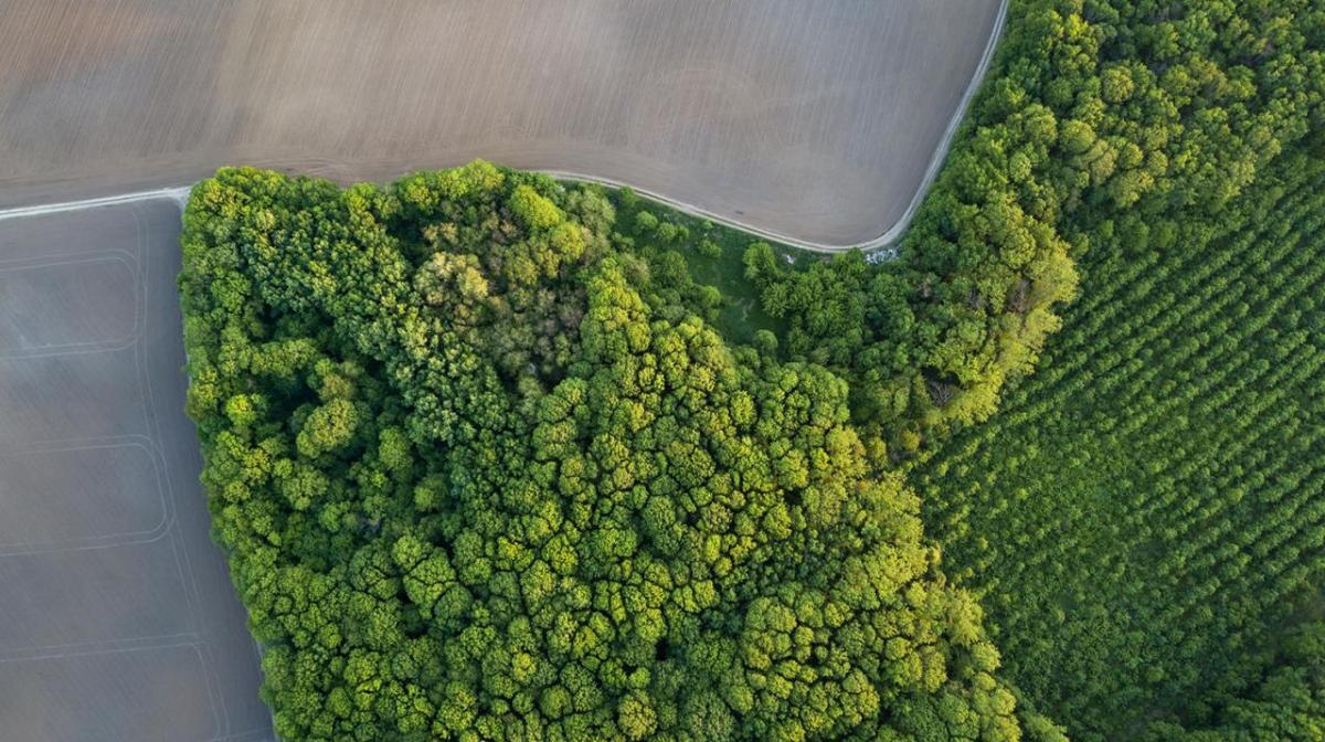
 for the state of São Paulo, with inset showing zoomed-in region with input RGB imagery")

By: Jamie Tolan, Camille Couprie, and Tracy Johns
The increase in atmospheric carbon dioxide levels and associated climate change has had a dramatic impact on the Earth’s biosphere, ranging from drought and wildfires to the loss of biodiversity. Forests play a central role in the carbon dioxide cycle, pulling carbon dioxide from the atmosphere and storing the carbon in their biomass. Forests also contain the majority of Earth’s terrestrial biodiversity. Despite this central role, the magnitude of the carbon dioxide absorbed every year by forests around the world is still largely unclear, due in part to the coarse resolution of global carbon models.
The United Nations Intergovernmental Panel on Climate Change (IPCC) has clarified that carbon removal is a crucial part of limiting global warming to levels of 1.5º C in comparison with pre-industrial temperatures. Forest management is recognized by the IPCC as one of the most important ways to achieve carbon removal at scale, and over the past decade, forest management has become the main source of carbon offsets in the voluntary market.
In 2020, Meta set a goal to reach net zero emissions across our value chain in 2030. As part of this, we are developing new technology solutions to mitigate our own carbon footprint and making these openly available to enable a broader impact on climate change (for example, read more on how we use AI to reduce concrete’s carbon footprint). In this article, we describe how we leveraged internal state-of-the-art AI technology and collaborated with the World Resources Institute (WRI) to develop a method to map forests, tree by tree, across areas the size of continents. As an example, we mapped the U.S. state of California and São Paulo, Brazil, and are making the data public and freely available.
How improved mapping helps achieve net zero
To achieve net zero emissions, Meta is focused on reducing our emissions by prioritizing efficiency and circularity in our business decisions, embracing low-carbon technology, and engaging with our suppliers to help them set climate targets. Some emissions from hard-to-abate sectors will remain difficult to completely eliminate by the end of this decade. For those emissions we cannot avoid, we will remove an equivalent amount of carbon dioxide by purchasing credits from carbon removal projects, including nature-based solutions that can be deployed now, as well as emerging technologies that need our support to scale. Forests are critical to achieving the global scale of carbon removal needed as outlined by the IPCC, and the market for high-quality, forest-based carbon removal needs to grow significantly to achieve this scale.
We believe that by improving measurement, reporting, and verification (MRV) of forest-based carbon removal projects, we can improve the quality and accelerate the growth of nature-based climate solutions. First, by lowering the barrier to forest monitoring solutions, we can enable small landowners to access carbon markets and increase the number of community-led carbon removal projects. Smaller, distributed tree growth (e.g., in agroforestry) lacks affordable and scalable monitoring solutions, which can hamper the development of such projects in smaller communities. Second, nature-based solutions can use more reliable data of the carbon stock in forests for both the baselining and the monitoring of forest carbon. Improved, freely available high-resolution data could potentially be used in standardized verification methodologies for certain projects. Both of these challenges can be addressed by improving fine-grained knowledge of forests at a global scale and making the data publicly available.
Description of our method
In order to make our mapping methodology useful for MRV of carbon projects, we set the following criteria: detect single trees (as small trees as possible) and be globally applicable. We also require that the method be applicable to different sources of imagery to allow for frequent updates of the canopy height maps.
Leveraging recent advances in self-supervised learning, namely the DINOv2 model we announced today, and our expertise in AI-based global mapping from high-resolution imagery, we have developed a machine learning approach that can detect canopy height with high fidelity from RGB imagery with a resolution of 0.5 m. We describe our model in detail in the preprint (link), which has been submitted for peer review. DINOv2 provides a self-supervised framework that’s trainable on any collection of licensed photos without needing any associated metadata. In this work, a DINOv2 model is trained on high-resolution (0.5 m) RGB satellite imagery from MAXAR Technologies in a self-supervised fashion. We then use aerial LIDAR data as a ground truth to learn canopy height maps (CHM). Since our ground truth is in North America and high-quality aerial LIDAR imagery is not globally available, we use spaceborne LIDAR data as a low-resolution and sparse but global data source to calibrate our model for global applicability.
Choosing the DINOv2’s self-supervised neural network learning allows for universal and generalizable features, which we believe facilitates global applicability of the model. The 0.5 m resolution allows us to map the canopy height of individual trees regardless of sparsity, undergrowth type, or species, which is crucial in achieving accurate biomass estimates. Leveraging our model, we create canopy height maps of California and São Paulo, Brazil (download the data here and view map here). We find that the model performs qualitatively well in Brazil, even though the high-resolution training data was from North America.
Since the model is trained on RGB imagery, it allows the analysis of generic RGB imagery resampled to the same 0.5 m resolution that the model has been trained on, so imagery collected by planes or drones, rather than by satellites, can also be used as input. This is particularly important since aerial RGB data is more widely available and allows for simple, cost-effective tracking of changes in canopy height over time.
As an example, we demonstrate that our model performs well on the aerial imagery of the NEON dataset, as shown in the figure above.
Conclusion
Our method enables large-scale analysis of high-resolution imagery, determining forest canopy height with sub-meter resolution. Accurate forest mapping in space and time will lead to more accountable forest-based carbon offsets and enable the development of more carbon projects, especially those on smaller pieces of land — two requirements for nature-based carbon offsets to achieve the scale and quality needed to meet net zero goals at a global scale.