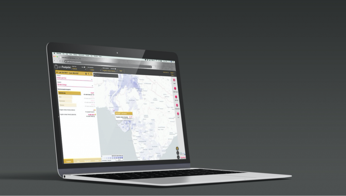
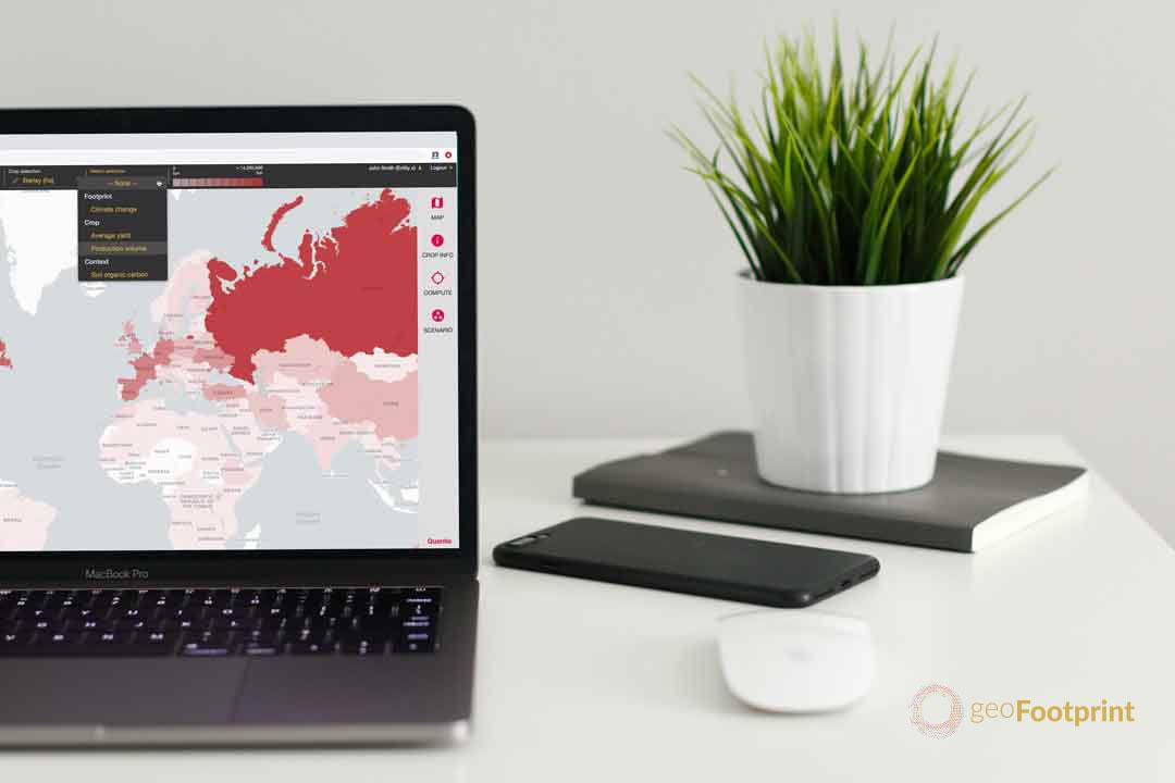
- Sustainability consulting group Quantis launches geoFootprint, the first tool to combine data from satellite imagery with environmental metrics to allow users to visualize the footprints of key commodity crops on an interactive world map at high resolution.
- Agriculture is responsible for more than 20% of global greenhouse gas emissions. The complex, globalized nature of agricultural supply chains presents a massive data management challenge for companies. To reduce their footprint and meet ambitious targets like carbon neutrality, they need to first understand the impact of how their crops are grown and managed.
- Companies and stakeholders across the supply chain can now instantly simulate the environmental footprints of crops, allowing for faster, better-informed and more sustainable decision making.
- In addition to the crops that underpin the global food system, geoFootprint provides insights on those important to the apparel, chemicals, cosmetics, biofuels and other bio-based industries.
- An open-access version of geoFootprint is available for non-expert audiences, students and other stakeholders to expand public knowledge on sustainable agriculture and the crop production risks posed by climate change.
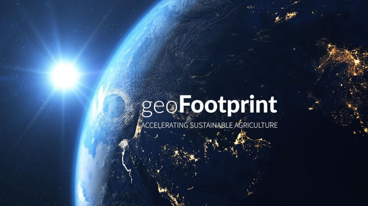
LAUSANNE, Switzerland, January 26, 2021 /3BL Media/ - Leading sustainability consulting firm Quantis launches geoFootprint, the first tool to use satellite imagery to visualize the environmental impact of crops on an interactive world map for smarter, science-driven decision making on sustainability. A multi-stakeholder initiative, geoFootprint was built collaboratively with more than 25 public, private and academic partners aiming to accelerate sustainable agriculture through innovation. With its global overview of crop footprints, geoFootprint closes the gap between the action needed to make agriculture more sustainable, and the knowledge required to pursue it.
Agriculture is a significant contributor to climate change, responsible for more than 20% of global greenhouse gas emissions. To tackle the environmental crisis, companies need a clear picture of the impact of their sourcing decisions. Globalized supply chains make this a complex challenge: Crops are traded globally, but their footprints are calculated locally. How and where a crop is grown changes the size of its environmental footprint.
geoFootprint opens up a new information channel, bringing visibility of on-the-farm and upstream impacts (from deforestation, fertilizer use, irrigation, land management and other factors) directly to strategic-level decision makers. Drawing on the best sources of publicly available data and displaying it on an interactive, high-resolution world map, geoFootprint fills a critical knowledge gap for companies and stakeholders across the supply chain. Questions about the environmental impacts of crops that were nearly impossible to answer can now be resolved in a matter of minutes. Users can easily understand a crop’s geography-specific footprint, identify what contributes to it and run simulations to see which interventions would have the most positive environmental impact on their supply chain.
In addition to delivering insights to inform sustainability decisions, geoFootprint enables users to assess the risks posed by changes in climate, water availability and quality, soil health, and biodiversity to secure supply chains and the future of food.
Xavier Bengoa, the geoFootprint project lead and a senior sustainability consultant at Quantis said:
“While agriculture is one of the largest contributors to the climate and biodiversity crisis, it also represents one of the most high-potential solutions. geoFootprint enables companies to reduce the environmental footprint of crops in their supply chains through providing insights that – until now – have been nearly impossible to capture. It fills a giant knowledge gap that will allow us to accelerate the sustainable transformation of agriculture.”
Laura Overton, Sustainability Accounting Senior Manager, Mars Incorporated and geoFootprint partner stated:
“geoFootprint promises to fulfill a valuable need for companies to better understand and ultimately to reduce their carbon footprints. The potential of the tool lies in combining spatially-detailed agricultural impacts with location-specific sourcing data.”
***END***
About geoFootprint
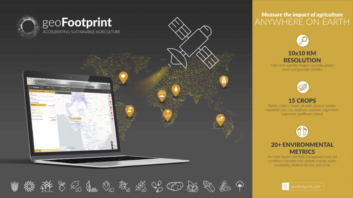
geoFootprint powerfully combines data from satellite imagery with more than 20 environmental metrics to visualize the environmental footprints of 15 key commodity crops on an interactive world map, delivering granular data that yields sharper insights for strategic decision making.
An initiative launched by Quantis in 2018 with financial support from EIT Climate-KIC, geoFootprint was built collaboratively in partnership with more than 25 public, private and academic stakeholders, including arx iT, Cool Farm Alliance and leading agrifood companies.
To enhance public knowledge on sustainable agriculture, the team created an open-access version of geoFootprint that makes solid environmental data of key commodity crops accessible to non-expert audiences, students or stakeholders that may not otherwise have access to this information. geoFootprint and geoFootprint Open will be publicly available in January 2021. The crops include barley, cotton, maize, oil palm, peanut, potato, rapeseed, rice, rye, sorghum, soybean, sugar beet, sugarcane, sunflower and wheat.
Discover geoFootprint at www.geofootprint.com
About Quantis
Quantis guides top organizations to define, shape and implement intelligent environmental sustainability solutions. In a nutshell, our creative geeks take the latest science and make it actionable. Our team of talents delivers resilient strategies, robust metrics, useful tools and credible communications for a more sustainable future.
A sustainability consulting group known for our metrics-based approach to sustainability, Quantis has offices in the US, France, Switzerland, Germany and Italy and has a diverse client portfolio that spans the globe.
We are Quantis: sustainability’s scientists, experts, strategists, innovators and visionaries.
Discover Quantis at www.quantis-intl.com
For media enquiries, contact:
Johanna Steves
Group Communications + PR, Quantis
[email protected]